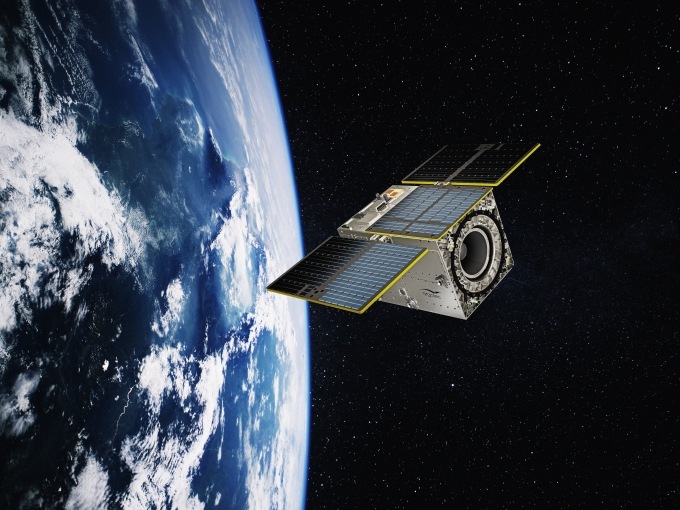
HEO Hawk Pathfinder (IRIDE) Mission by Argotec with Anywaves’ GNSS antenna in orbit
HEO Hawk (IRIDE) Mission: A New Benchmark in European Earth Observation
When a space systems integrator or prime contractor evaluates a radio or GNSS antenna sub-contractor, what matters most is reliability, heritage, and seamless integration into a satellite’s system. For Anywaves, contributing our GNSS antenna to Argotec’s HEO Hawk (IRIDE) mission is a milestone, not only from a technical integration viewpoint, but also from a strategic mission-level standpoint.
Argotec, an Italian space company with growing prominence, is leading the HEO (Hawk for Earth Observation) constellation under the IRIDE programme – a flagship Earth observation endeavour at the European scale.
By choosing Anywaves, Argotec trusted our GNSS solution to deliver precise orbit and attitude reference across a constellation operating in Low Earth Orbit.
This article outlines the mission’s context, the satellite platform, our antenna’s role onboard, and the next steps for IRIDE and its Pathfinder satellite.
About the Mission: IRIDE & HEO Hawk
IRIDE Programme: Strategic Context
When looking at the European space landscape, IRIDE stands out as one of the most ambitious national Earth-observation initiatives of the decade. Funded by Italy’s National Recovery and Resilience Plan (PNRR) and managed jointly by the European Space Agency (ESA) and the Italian Space Agency (ASI), IRIDE is not a single mission but a system of systems: a coordinated network of constellations designed to deliver high-resolution, multi-modal data about our planet.
A constellation of constellations
The IRIDE architecture integrates a broad range of sensing capabilities across different orbital regimes and payload types:
- Optical satellites for high-resolution imaging;
- Hyperspectral payloads to capture the chemical composition of surfaces;
- Radar (SAR) satellites providing all-weather, day-and-night monitoring;
- and high-orbit or infrared sensors complementing the coverage.
Together, these constellations form a comprehensive Earth-observation infrastructure capable of supplying real-time environmental, meteorological, and security information to public and private stakeholders.
The role of Argotec and the HEO constellation
Within this framework, Argotec is responsible for developing the HEO (Hawk for Earth Observation) microsatellite constellation. The company brings its expertise in miniaturised satellite platforms and advanced onboard computing, contributing to the segment of the IRIDE system focused on high-revisit optical imaging.
- The HEO satellites are microsatellites (~65 kg class) engineered to operate in Sun-synchronous orbits (SSO) at altitudes typically between 500–600 km.
- The goal is to deliver multispectral optical Earth observation with high revisit cadence, supporting climate monitoring, disaster response, land use, public services, etc.
- HEO is not just a passive imager: it embeds significant on-board processing capability (CPU, GPU, Neural Processing Unit) to perform “on-the-edge” image processing, reducing downlink burdens and enabling rapid data delivery.
- The imaging performance is sub-3 m GSD (ground sampling distance) in certain modes.
- Propulsion, precise pointing, onboard autonomy, and constellated operations are all key design drivers.
In short, IRIDE is not only a technological programme but a sovereign data infrastructure, and HEO Hawk is one of its key operational pillars.
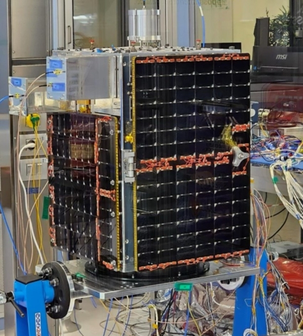
IRIDE Pathfinder Hawk satellite. Credits; Argotec
The HEO Satellite Platform
Inside the HEO bus: performance, autonomy, and design architecture
To understand where our GNSS antenna fits in, it helps to look into the satellite subsystems and the trade space.
Key Satellite Characteristics
- Mass & Volume: Wet mass below ~72.6 kg.
- Power & Data: Up to ~200 W generation, ~344 Wh battery storage. Payload data downlink can reach 218 Mbps.
- Payload Data Processor (PDP): Argotec provides an x86 quad-core architecture, GPU, FPGA, and NPU, enabling advanced on-board processing pipelines.
- Attitude & Orbit Control: 3-axis stabilization, pointing accuracy ~10.8 arcsec, and orbit knowledge augmented via GNSS (precision ~2 m).
- Propulsion: A chemical propulsion system providing ΔV ~80 m/s.
- Telemetry & Communication: Standard S-Band / X-Band links for TM/TC, and high-rate payload downlink.
- Mission Lifetime & Architecture: Designed for constellation operations, with production streamlined in Argotec’s Space Park.
Every subsystem is tuned to the constraints and synergies of constellation-scale deployment: size, cost, integrated avionics, and robust autonomy.
Operational & Flight Segment
Argotec has prepared the Flight Operations Segment (FOS) to support real-time operations of HEO. The FOS establishes the baseline for commanding, health monitoring, scheduling, and data downlink for the constellation.
The synergy between on-board autonomy and ground operations is central: anomalies, reconfigurations or prioritized observations must be coordinated swiftly across the constellation, while minimizing operator load.
Pathfinder: The First HEO Hawk Satellite
The first mission in the series, Pathfinder, marks the operational debut of the HEO architecture.
Launched on 14 January 2025 aboard a SpaceX Falcon 9 from Vandenberg, Pathfinder operates at ~590 km altitude, serving as a demonstrator for the full constellation.
Its objectives:
- Validate the spacecraft bus and payload integration;
- Calibrate imaging instruments and ground segment;
- Qualify navigation, propulsion, and pointing performance;
- Prepare for the full deployment of the upcoming HEO satellites.
Just months later, on 23 June 2025, seven additional HEO satellites joined Pathfinder in orbit — marking a major milestone in IRIDE’s rollout.
Argotec has since been contracted to deliver up to 25 satellites, establishing a truly industrialised, constellation-scale production line at its Space Park facilities in Turin.
Pathfinder’s success in orbit not only confirms the viability of Argotec’s microsatellite design but also validates the navigation performance delivered by our antenna.
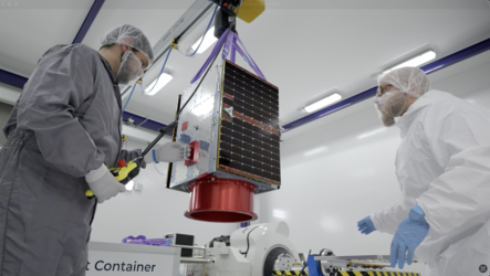
IRIDE HEO Pathfinder satellite in the cleanroom. Credits: Argotec
Anywaves GNSS Antenna Onboard
For a constellation like HEO Hawk, precise orbit and attitude knowledge are mission-critical. That’s where the GNSS subsystem plays a decisive role by providing the position, velocity, and timing data that underpin accurate imaging and constellation coordination.
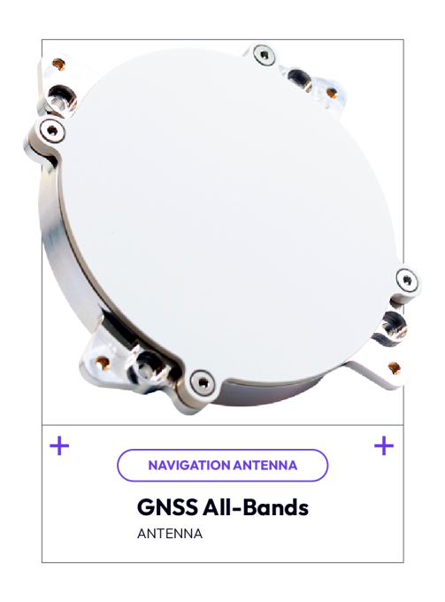 A robust, flight-proven solution
Rather than a one-off development, the antenna integrated on HEO Hawk is Anywaves’ GNSS All-Bands Antenna.
Already flying on several LEO and constellation missions, it’s engineered to deliver high reliability and low integration risk.
- Multi-constellation and multi-band coverage: GPS, Galileo, GLONASS, and BeiDou on L1/E1 and L2/E5 bands.
- Compact and lightweight: Ideal for microsatellite and CubeSat platforms.
- Stable phase centre & low axial ratio: Ensuring accurate orbit determination and geolocation.
- Rugged composite housing: Qualified for vibration, radiation, and thermal extremes.
- Plug-and-play integration: Ready mechanical and RF interfaces compatible with Argotec’s avionics.
Enabling precise orbit and timing
In the HEO constellation, the GNSS antenna feeds the onboard receiver that provides real-time orbit determination and attitude reference to the spacecraft’s control system. This data is essential for:
- maintaining orbital accuracy across multiple satellites,
- ensuring geolocation precision for payload imagery, and
- synchronising acquisition across the constellation.

This image of Rome is the very first captured by Hawk for Earth Observation (HEO) Pathfinder, the inaugural microsatellite of the IRIDE Spazio program. Credits: Argotec
Mission Status & Next Steps
From Pathfinder Launch to Full Constellation Deployment
As of mid-2025, the IRIDE programme has reached key milestones:
- Pathfinder launch: 14 January 2025 aboard SpaceX Falcon 9 (Vandenberg).
- Acquisition confirmed: Within hours of separation, full telemetry established.
- First high-resolution imagery: On 5 March 2025, Pathfinder Hawk captured and transmitted its first Earth-observation image, unveiled publicly on 30 March 2025.
The image, a high-detail strip covering the Italian peninsula, including Rome, at 2.66-meter ground sampling distance, demonstrated a threefold improvement over standard regional datasets previously available.
This first capture validated the imaging chain, pointing stability, and the orbit determination accuracy supported by the GNSS subsystem. - Seven new satellites: Added to orbit on 23 June 2025, expanding the constellation.
- Commissioning phase: Ongoing — calibration, orbit maintenance, imaging validation, and cross-satellite alignment.
- Next deliveries: Argotec contracted for 15 more satellites, targeting full deployment through 2026.
Upcoming Objectives
- Finalize commissioning and calibration for Pathfinder and the first batch of HEO satellites.
- Full constellation rollout — reaching up to 25 units by 2026.
- Transition to operational phase — continuous imaging for civil, scientific, and governmental users.
- Data product expansion — change detection, time-series analytics, and fused data services.
- Future upgrades — potential for extended mission lifetime and synergy with other IRIDE constellations (hyperspectral, SAR, etc.).
These milestones collectively validate both Argotec’s microsatellite concept and the navigation reliability enabled by Anywaves’ antenna.
Conclusion
The HEO Hawk Pathfinder mission represents a major step forward in European Earth observation, blending industrial scalability, technological autonomy, and precision navigation.
For Anywaves, this mission is another demonstration of how a compact yet high-performance subsystem can enable complex constellation operations.
HEO is now entering its operational phase, with further constellation expansion to come. As the constellation grows, so will the satellite network’s power to deliver timely, actionable Earth observation data. We are proud to play a role in that future.
If you are planning a constellation mission and require a reliable, flight-proven GNSS solution, discover how Anywaves can support your next satellite design.
Contact
us
If you have any question, we would be happy to help you out.
